| Support Data | ||||
|---|---|---|---|---|
| View | ||||
| map_02952_19Jul02.gif | Map showing flight track for this day | |||
| Quick Analysis | ||||
| View | ||||
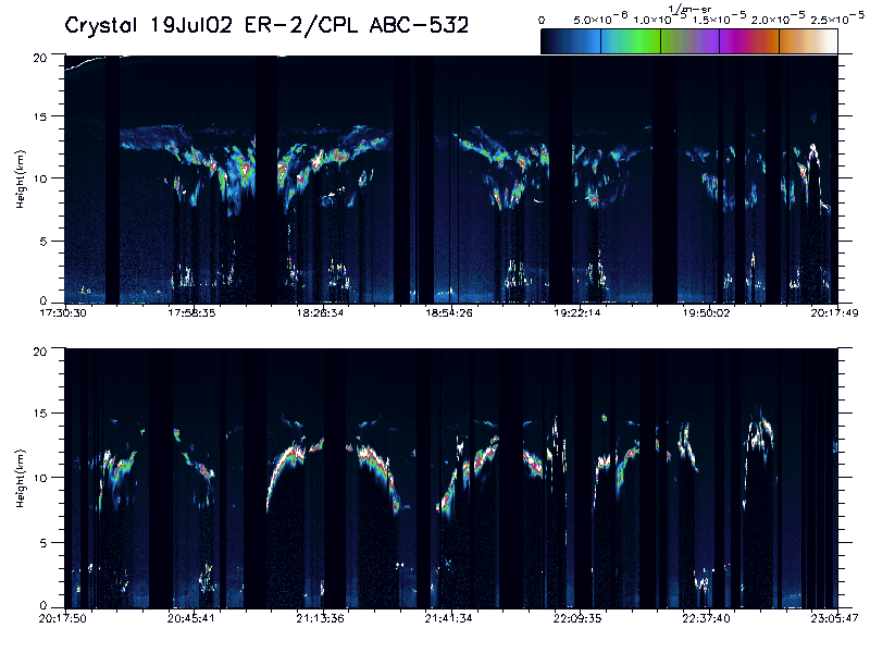
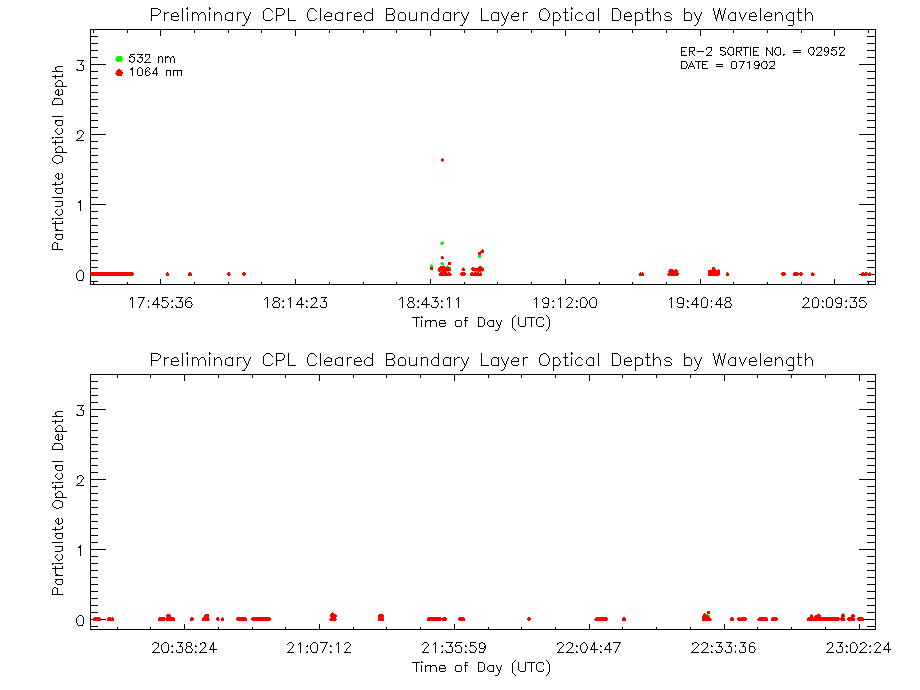
| imgsum_02952_19Jul02.gif | Flight summary image showing whole flight in one wavelength | |||
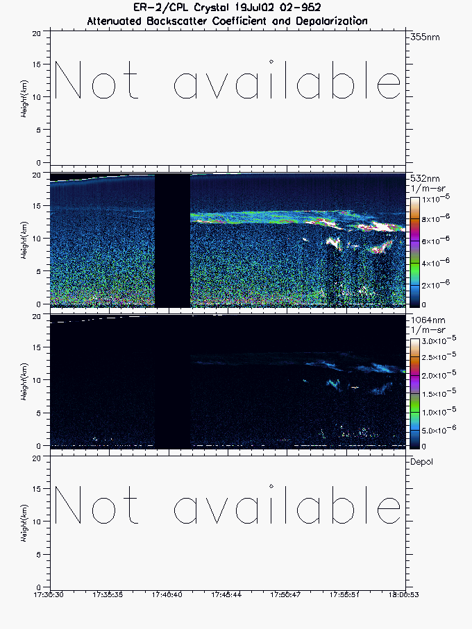
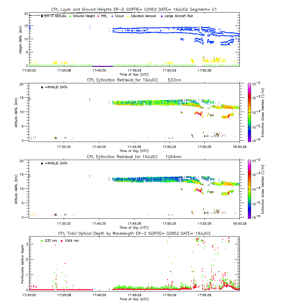
| imgseg01_02952_19Jul02.gif | Start time = 17:30:29 End time = 18:00:52 | |||
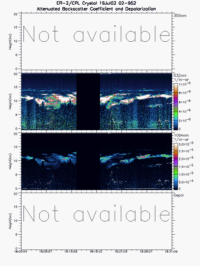
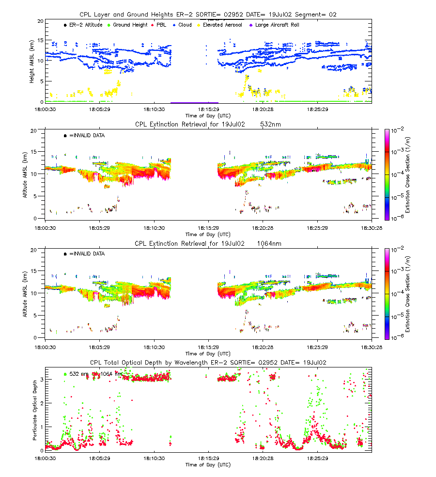
| imgseg02_02952_19Jul02.gif | Start time = 18:00:53 End time = 18:31:08 | |||
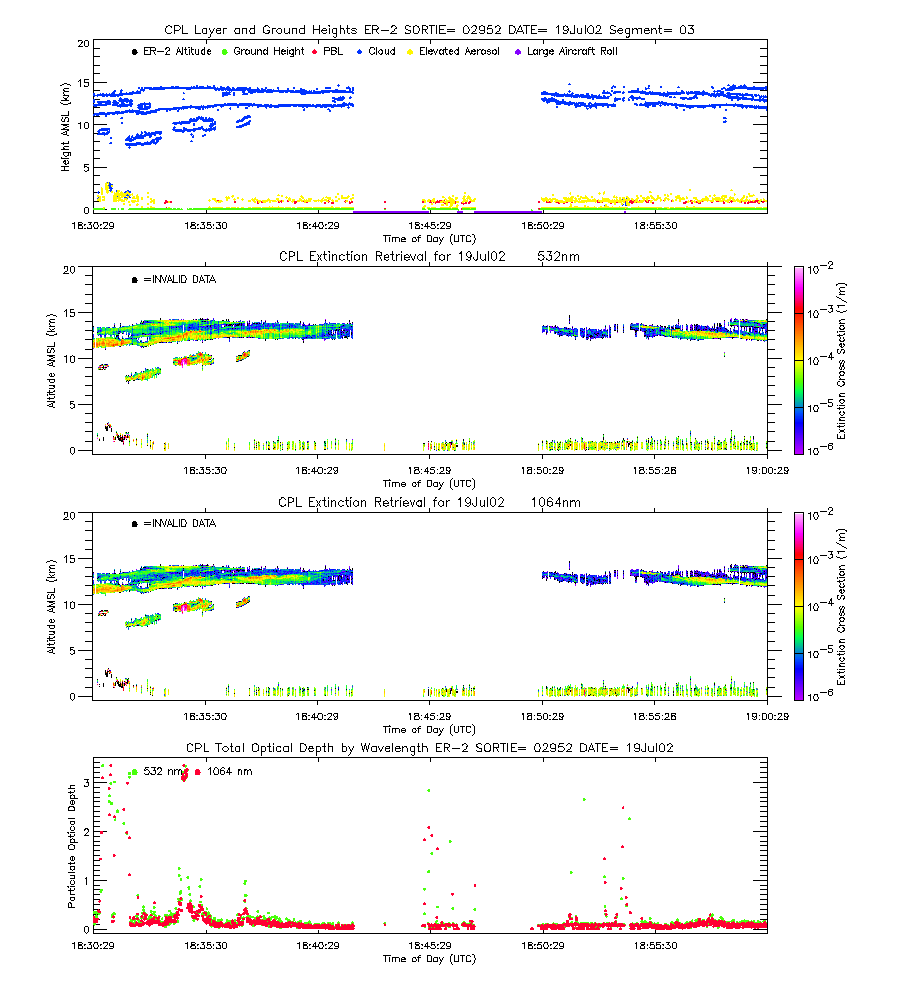
| imgseg03_02952_19Jul02.gif | Start time = 18:31:09 End time = 19:01:17 | |||
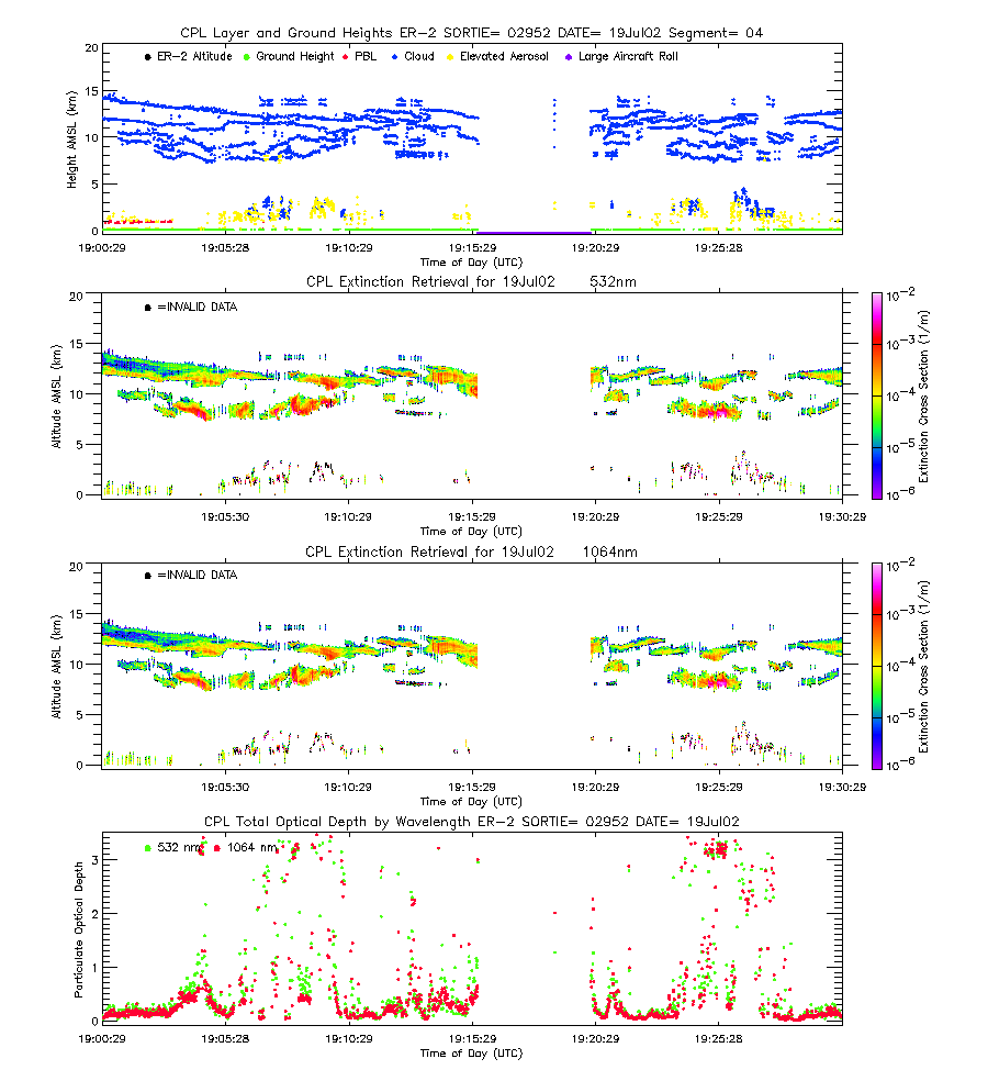
| imgseg04_02952_19Jul02.gif | Start time = 19:01:18 End time = 19:31:22 | |||
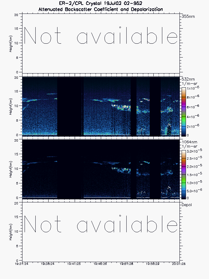
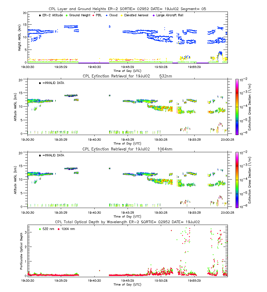
| imgseg05_02952_19Jul02.gif | Start time = 19:31:23 End time = 20:01:27 | |||
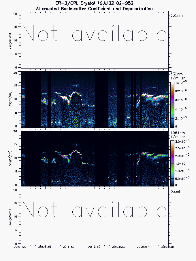
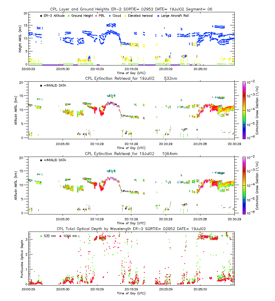
| imgseg06_02952_19Jul02.gif | Start time = 20:01:28 End time = 20:31:34 | |||
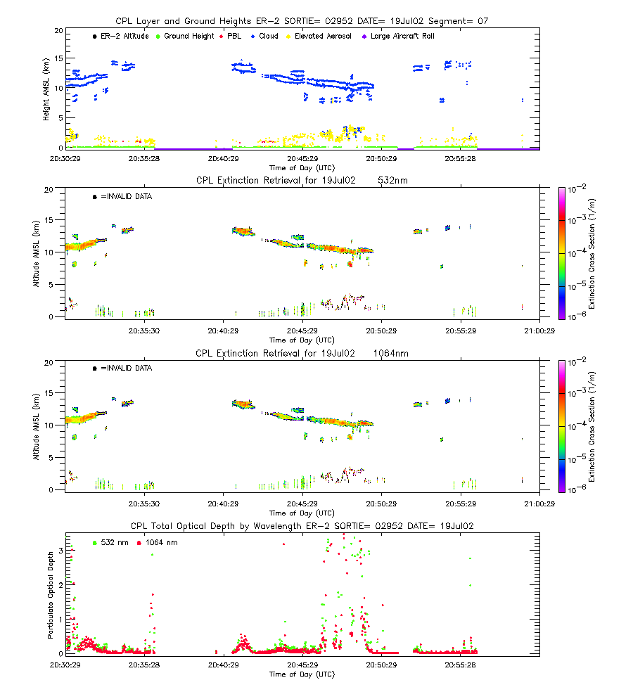
| imgseg07_02952_19Jul02.gif | Start time = 20:31:35 End time = 21:01:45 | |||
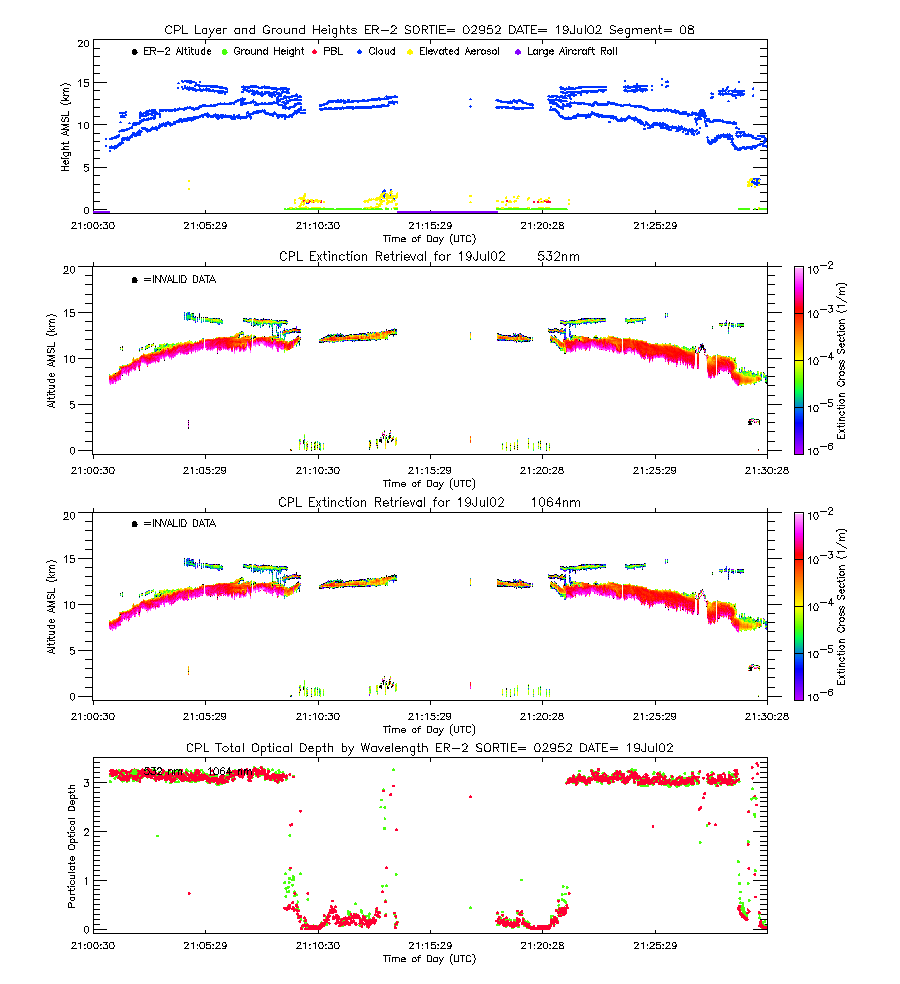
| imgseg08_02952_19Jul02.gif | Start time = 21:01:46 End time = 21:31:59 | |||
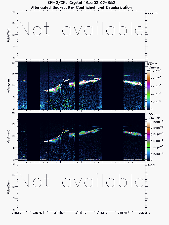
| imgseg09_02952_19Jul02.gif | Start time = 21:32:00 End time = 22:02:18 | |||
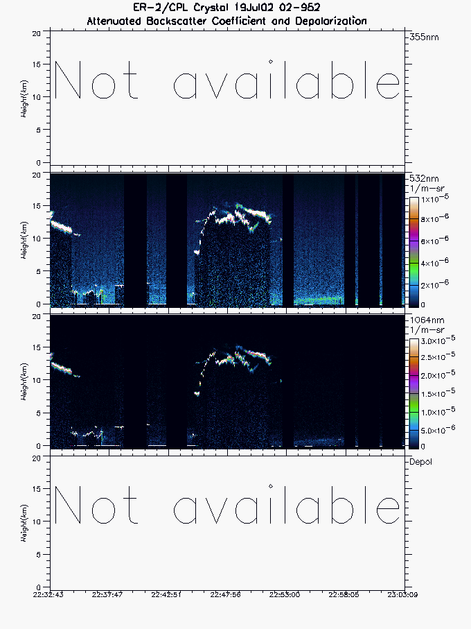
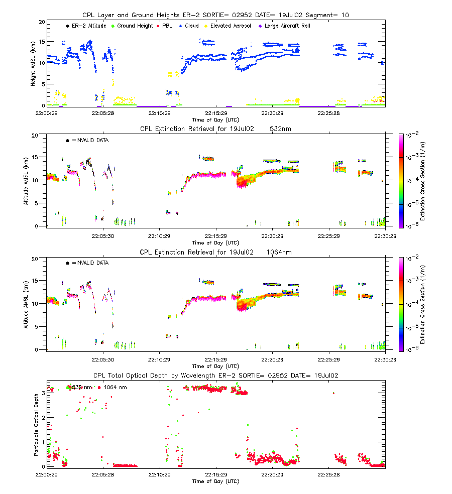
| imgseg10_02952_19Jul02.gif | Start time = 22:02:19 End time = 22:32:41 | |||
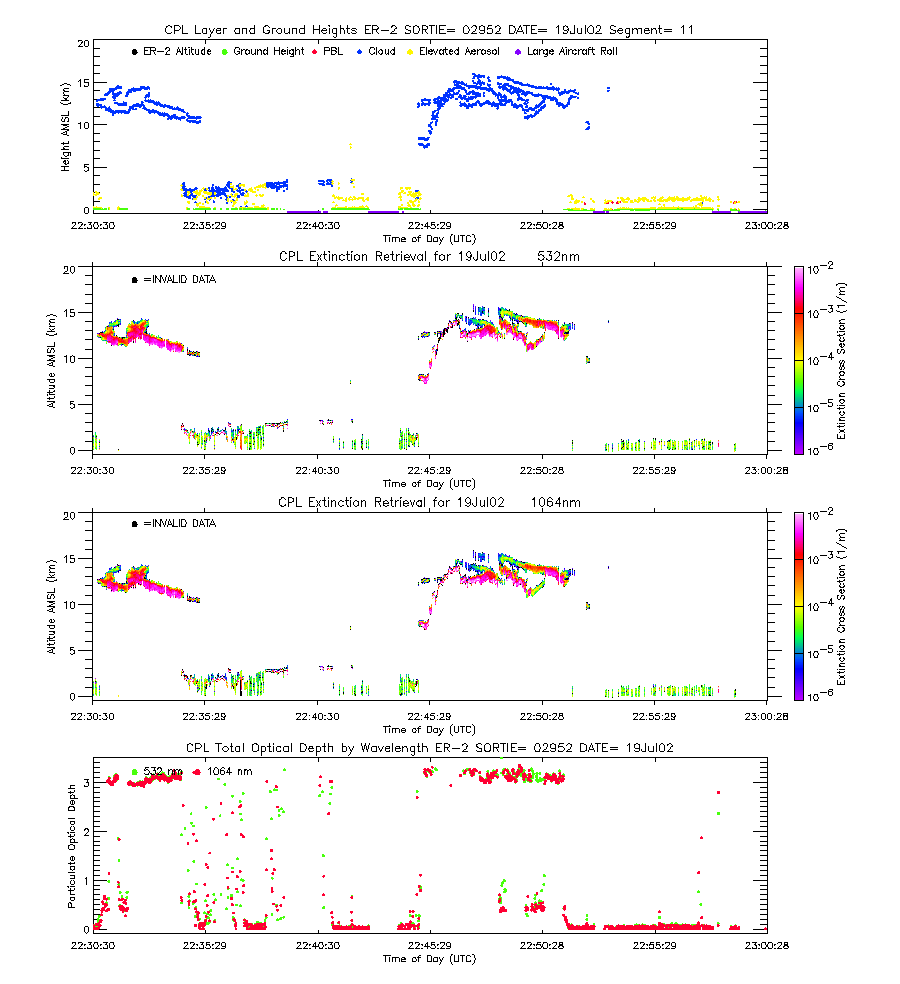
| imgseg11_02952_19Jul02.gif | Start time = 22:32:41 End time = 23:03:08 | |||
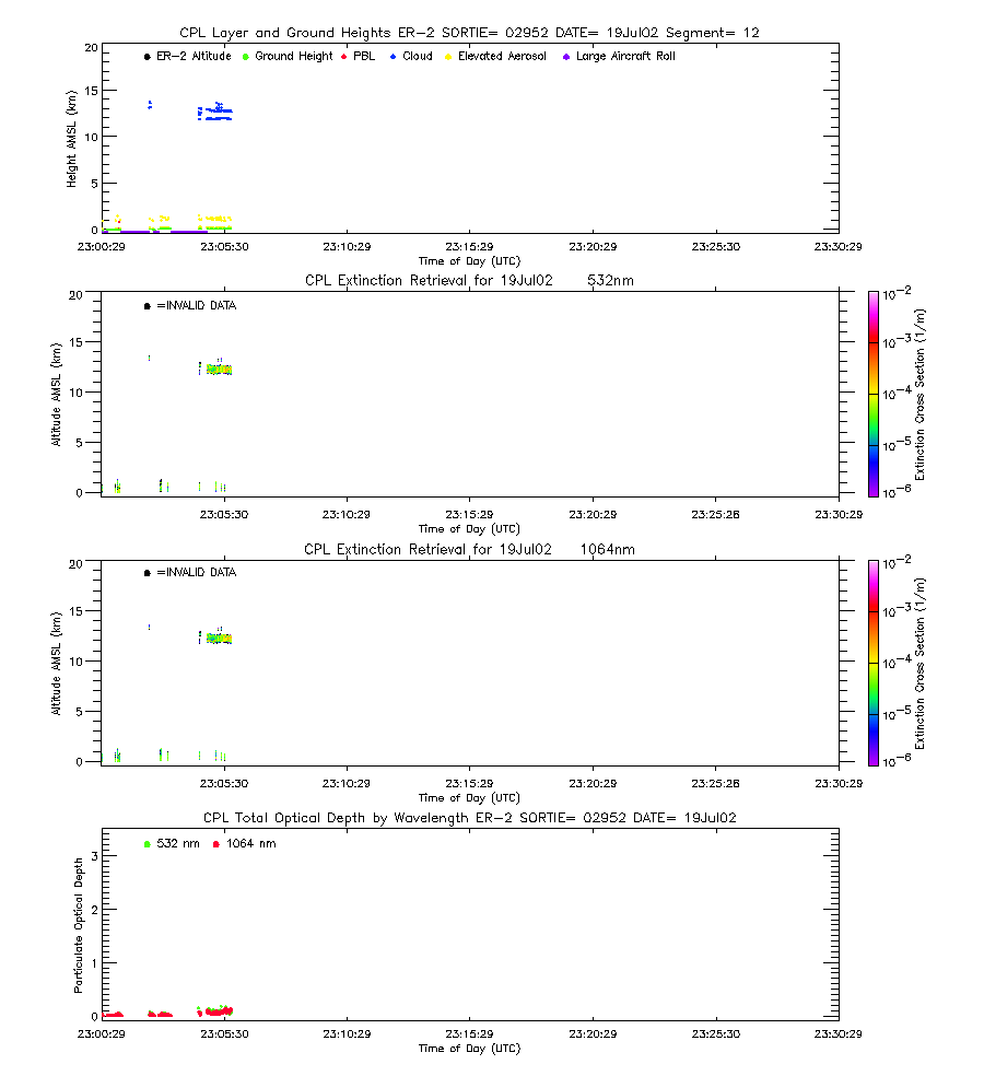
| imgseg12_02952_19Jul02.gif | Start time = 22:03:09 End time = 23:05:48 | |||
| layers_02952_19Jul02.txt | Layer boundary file showing type and location of all atmospheric layers sensed | |||
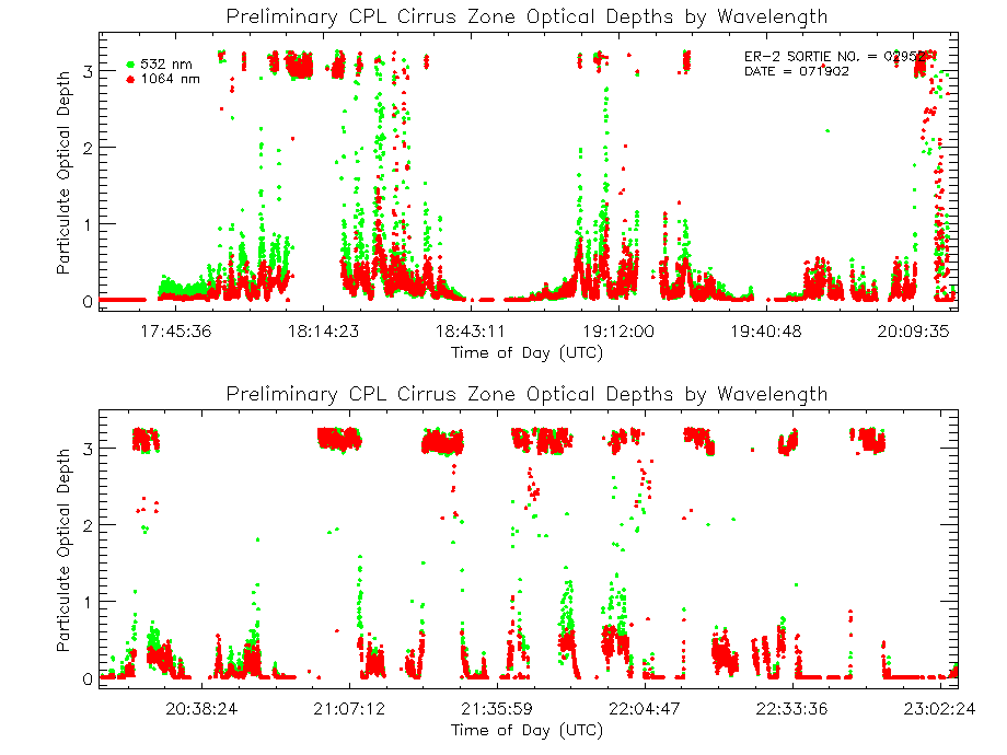
| CIPBL_02952_19Jul02.txt | Quick optical file showing optical depth and extinction-to-backscatter ratio calculations for a pre-defined cirrus zone and the cloud-cleared Planetary Boundary Layer for 355, 532, and 1064 nm. | |||
| CIPBL_readme.txt | Text file describing how to interpret and use the quick optical file. | |||
| CIOD_02952_19Jul02.gif | Optical Depth Plots (Cirrus), from the Quick Optical File | |||
| PBLOD_02952_19Jul02.gif | Optical Depth Plots (PBL), from the Quick Optical File | |||
| Complex Analysis | ||||
| View | ||||
| EXTSEG01_02952_19Jul02.gif | Start time = 17:30:29 End time = 18:00:52 | |||
| EXTSEG02_02952_19Jul02.gif | Start time = 18:00:53 End time = 18:31:08 | |||
| EXTSEG03_02952_19Jul02.gif | Start time = 18:31:09 End time = 19:01:17 | |||
| EXTSEG04_02952_19Jul02.gif | Start time = 19:01:18 End time = 19:31:22 | |||
| EXTSEG05_02952_19Jul02.gif | Start time = 19:31:23 End time = 20:01:27 | |||
| EXTSEG06_02952_19Jul02.gif | Start time = 20:01:28 End time = 20:31:34 | |||
| EXTSEG07_02952_19Jul02.gif | Start time = 20:31:35 End time = 21:01:45 | |||
| EXTSEG08_02952_19Jul02.gif | Start time = 21:01:46 End time = 21:31:59 | |||
| EXTSEG09_02952_19Jul02.gif | Start time = 21:32:00 End time = 22:02:18 | |||
| EXTSEG10_02952_19Jul02.gif | Start time = 22:02:18 End time = 22:32:41 | |||
| EXTSEG11_02952_19Jul02.gif | Start time = 22:32:42 End time = 23:03:08 | |||
| EXTSEG12_02952_19Jul02.gif | Start time = 23:03:09 End time = 23:05:48 | |||
| COD_02952_19Jul02.gif | Cloud Optical Depth Plot (three wavelength) | |||
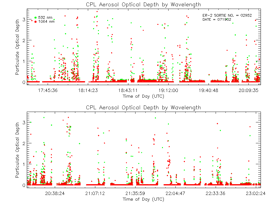
| AOD_02952_19Jul02.gif | Aerosol Optical Depth Plot (three wavelengths) | |||
| TOD_02952_19Jul02.gif | Total Optical Depth Plot (three wavelength) | |||