| Support Data | ||||
|---|---|---|---|---|
| View | ||||
| map_04605_16oct03.gif | Map showing flight track for this day | |||
| Quick Analysis | ||||
| View | ||||
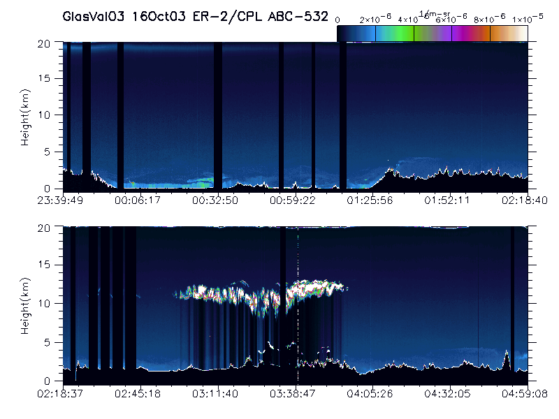
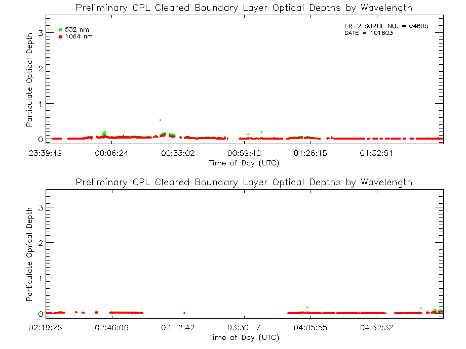
| imgsum_04605_16oct03.gif | Flight summary image showing whole flight in one wavelength | |||
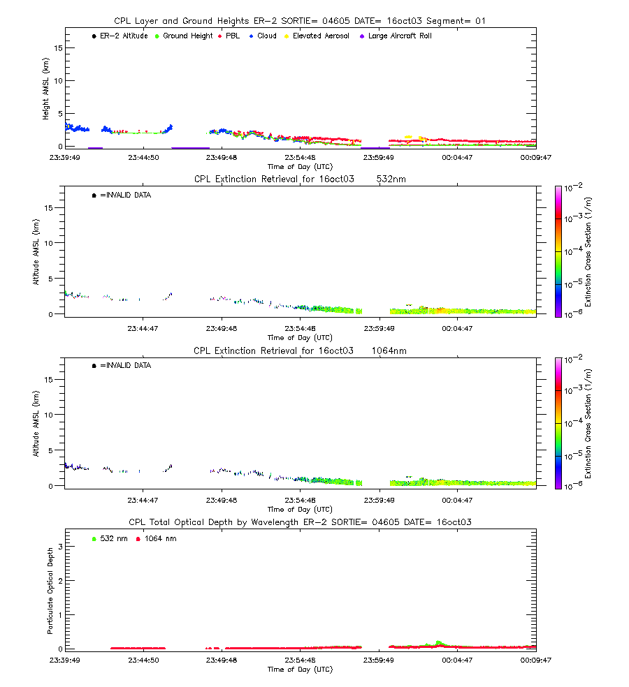
| imgseg01_04605_16oct03.gif | Start time = 23:39:49 End time = 00:09:51 | |||
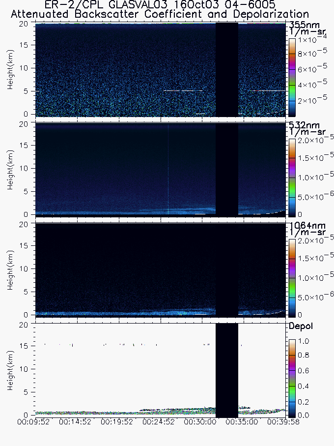
| imgseg02_04605_16oct03.gif | Start time = 00:09:52 End time = 00:39:58 | |||
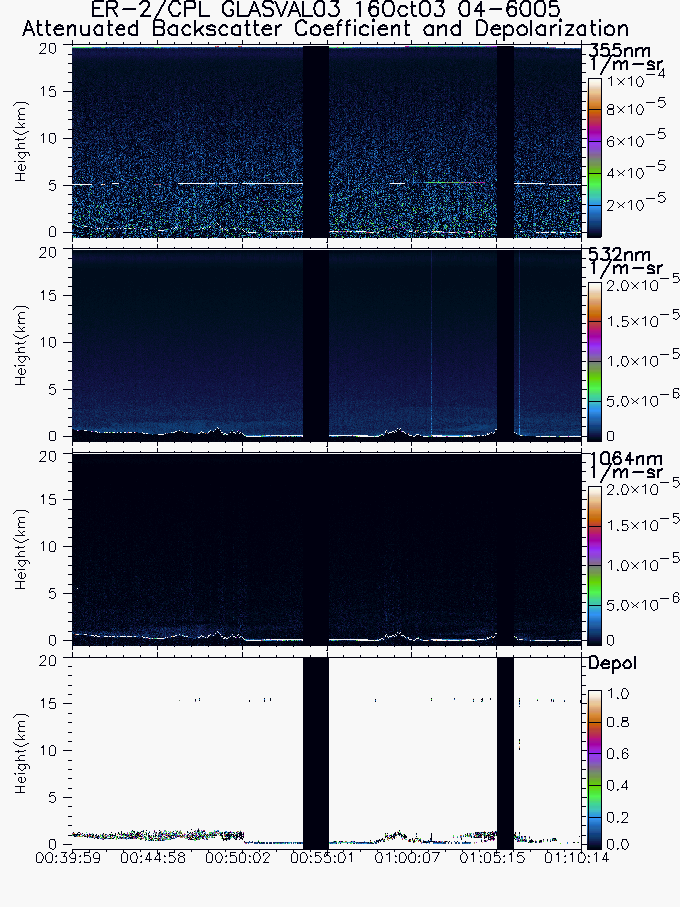
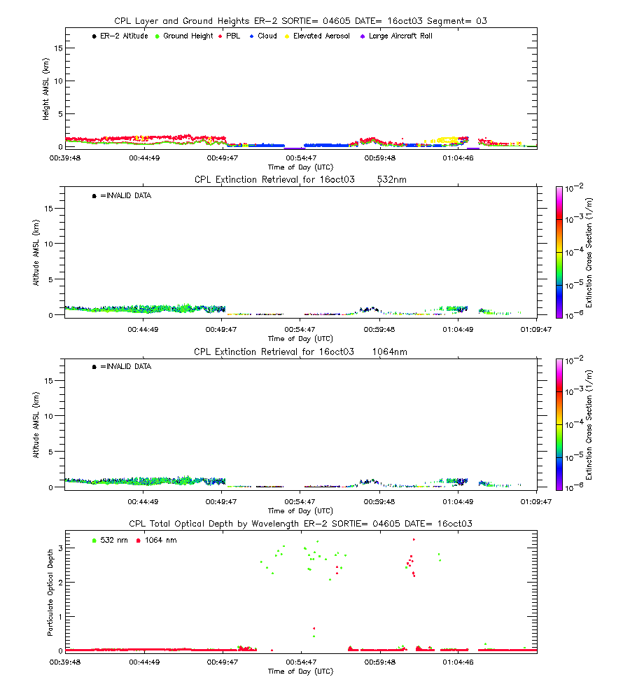
| imgseg03_04605_16oct03.gif | Start time = 00:39:59 End time = 01:10:14 | |||
| imgseg04_04605_16oct03.gif | Start time = 01:10:14 End time = 01:40:10 | |||
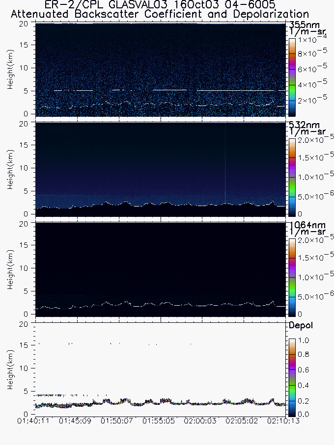
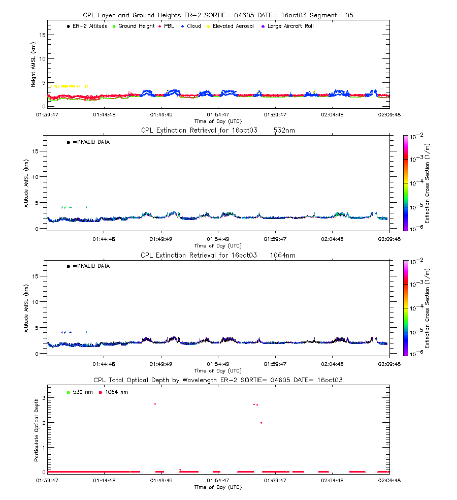
| imgseg05_04605_16oct03.gif | Start time = 01:40:11 End time = 02:10:13 | |||
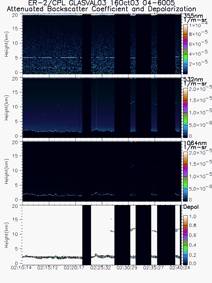
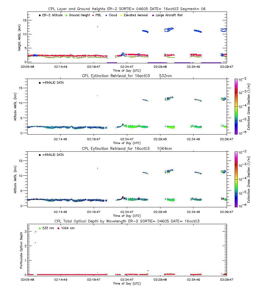
| imgseg06_04605_16oct03.gif | Start time = 02:10:14 End time = 02:40:24 | |||
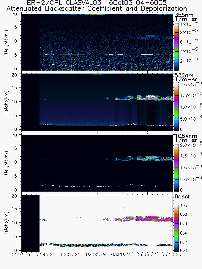
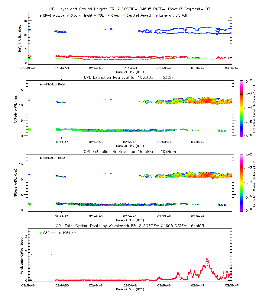
| imgseg07_04605_16oct03.gif | Start time = 02:40:25 End time = 03:10:20 | |||
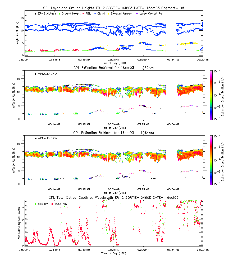
| imgseg08_04605_16oct03.gif | Start time = 03:10:21 End time = 03:41:07 | |||
| imgseg09_04605_16oct03.gif | Start time = 03:41:08 End time = 04:11:13 | |||
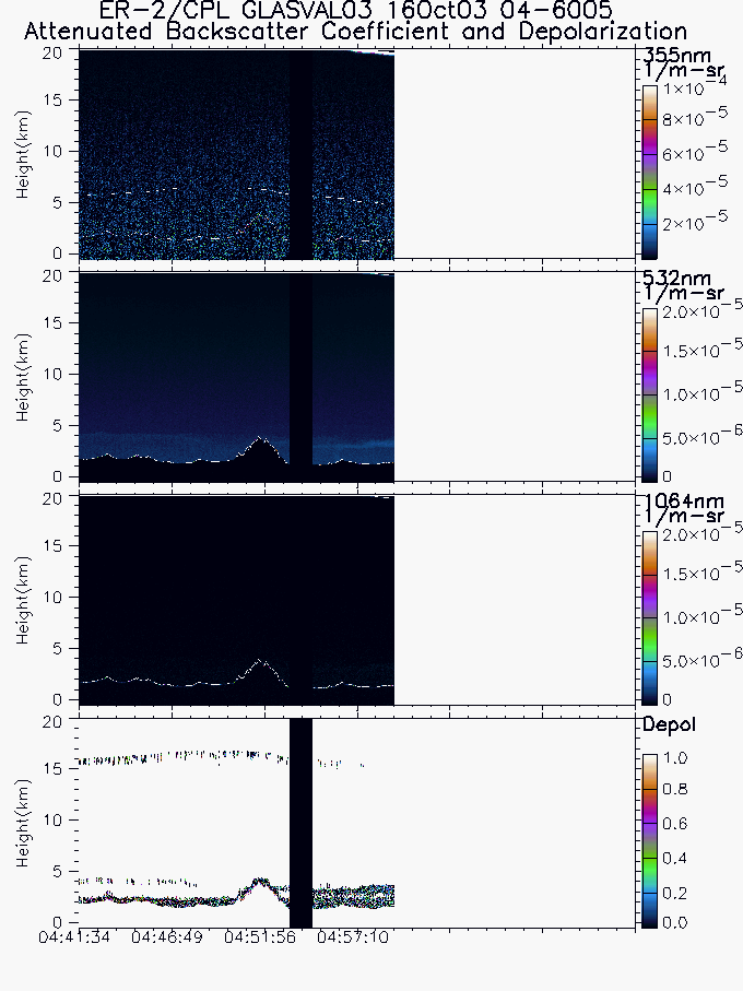
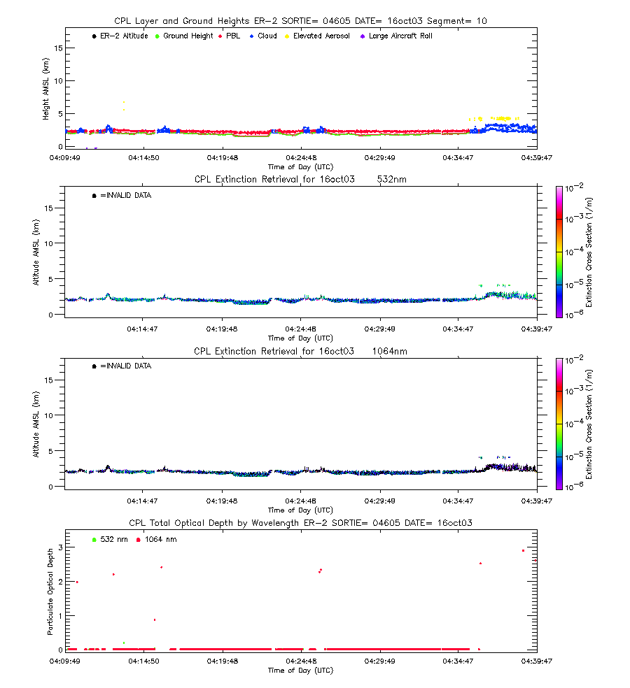
| imgseg10_04605_16oct03.gif | Start time = 04:11:14 End time = 04:41:33 | |||
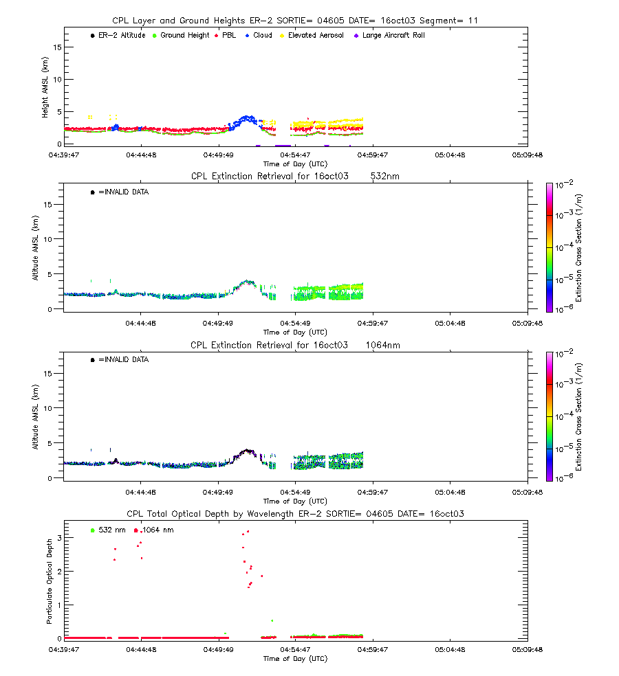
| imgseg11_04605_16oct03.gif | Start time = 04:41:34 End time = 04:59:08 | |||
| layers_04605_16oct03.txt | Layer boundary file showing type and location of all atmospheric layers sensed | |||
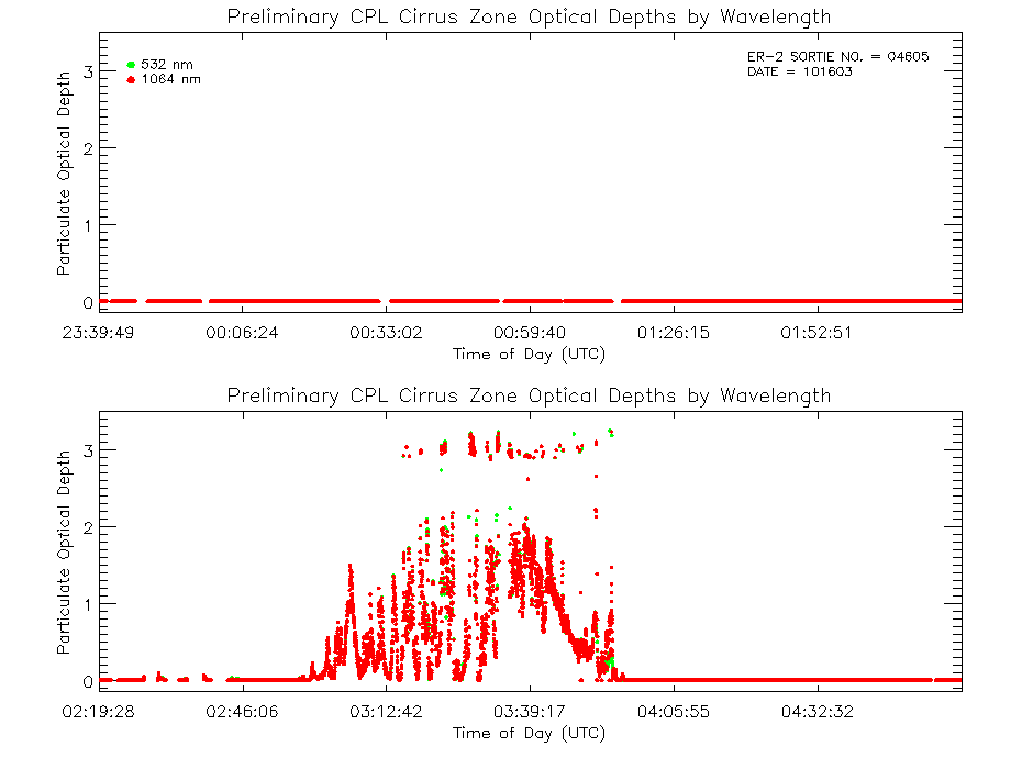
| cipbl_04605_16oct03.txt | Quick optical file showing optical depth and extinction-to-backscatter ratio calculations for a pre-defined cirrus zone and the cloud-cleared Planetary Boundary Layer for 355, 532, and 1064 nm. | |||
| CIPBL_readme.txt | Text file describing how to interpret and use the quick optical file. | |||
| ciod_04605_16oct03.gif | Optical Depth Plots (Cirrus), from the Quick Optical File | |||
| pblod_04605_16oct03.gif | Optical Depth Plots (PBL), from the Quick Optical File | |||
| Complex Analysis | ||||
| View | ||||
| EXTSEG01_04605_16oct03.gif | Start time = 23:39:49 End time = 00:09:51 | |||
| EXTSEG02_04605_16oct03.gif | Start time = 00:09:52 End time = 00:39:58 | |||
| EXTSEG03_04605_16oct03.gif | Start time = 00:39:59 End time = 01:10:14 | |||
| EXTSEG04_04605_16oct03.gif | Start time = 01:10:15 End time = 01:40:10 | |||
| EXTSEG05_04605_16oct03.gif | Start time = 01:40:11 End time = 02:10:13 | |||
| EXTSEG06_04605_16oct03.gif | Start time = 02:10:14 End time = 02:40:24 | |||
| EXTSEG07_04605_16oct03.gif | Start time = 02:40:25 End time = 03:10:20 | |||
| EXTSEG08_04605_16oct03.gif | Start time = 03:10:21 End time = 03:41:07 | |||
| EXTSEG09_04605_16oct03.gif | Start time = 03:41:08 End time = 04:11:13 | |||
| EXTSEG10_04605_16oct03.gif | Start time = 04:11:14 End time = 04:41:33 | |||
| EXTSEG11_04605_16oct03.gif | Start time = 04:41:34 End time = 04:59:08 | |||
| cod_04605_16oct03.gif | Cloud Optical Depth Plot (three wavelength) | |||
| aod_04605_16oct03.gif | Aerosol Optical Depth Plot (three wavelengths) | |||
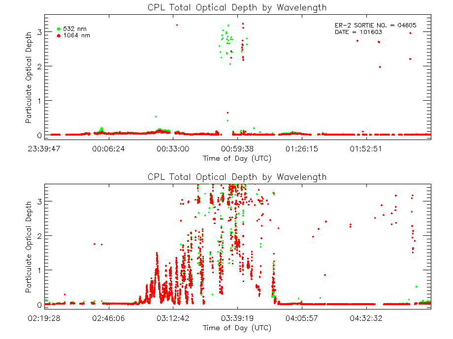
| tod_04605_16oct03.gif | Total Optical Depth Plot (three wavelength) | |||