Data products for December 10, 2003

NOTE: Due to laser electronics failure, CPL data and data quality for December 8-14 is greatly reduced. We are posting only 1064 nm flight images, depolarization, and layer boundaries, and even this data has degraded signal-to-noise. Higher level data products are not available for these days.

Support Data
View
Filename
Type
Descriptions and Comments
Calibration File map_04624_10dec03.gif
GIF
Map showing flight track for this day
Quick Analysis
View
Filename
Type
Descriptions and Comments
Flight Summary Image imgsum_04624_10dec03.gif
GIF
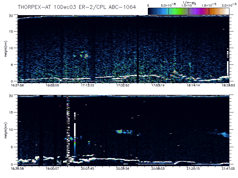
Flight summary image showing whole flight in one wavelength
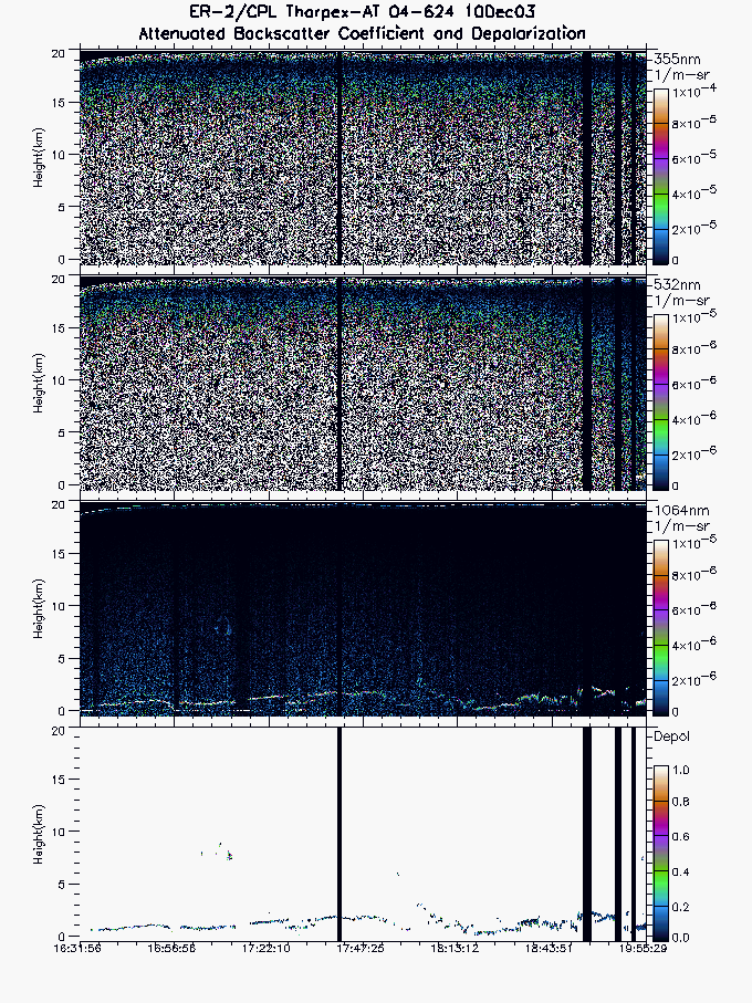
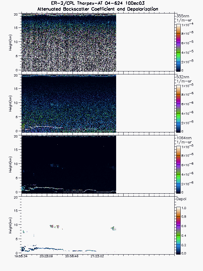
The following are images averaged at 5-second intervals (5 times normal CPL resolution) 1064 backscatter signals plus depolarizaton ratio for 1064:
Image Segment 1 imgseg01_04624_10dec03.gif
GIF
Start time = 16:31:56 End time = 19:55:29
Image Segment 2 imgseg02_04624_10dec03.gif
GIF
Start time = 19:55:34 End time = 21:41:05
The following images and files are for the entire flight:
Layer Boundary File layers_04624_10dec03.txt
TEXT
Layer boundary file showing type and location of all atmospheric layers sensed

Large Binary Output Files
File Size
Filename
Type
Descriptions and Comments
97 MB
NRB_04624_10dec03.xdr 
XDR
NRB Binary Output containing Lidar profiles after instrument corrections but before calibrated backscatter
text cal_04624_10dec03.final
TEXT
Request calibration file. This file contains the instrument calibration coefficients used to generate attenuated backscatter data from the NRB binary data.
*Note* Binary output files are large (most files are 500MB). *Note*
If you want the binary output files above, please click on the filename to download.


Go Back