Image centered on the satellite overpass (right-click to download image):

Image centered on the satellite overpass (right-click to download image):
| Support Data | ||||
|---|---|---|---|---|
| View | ||||
| map_09625_07jul09.gif | Map showing flight track for this day | |||
| Quick Analysis | ||||
| View | ||||
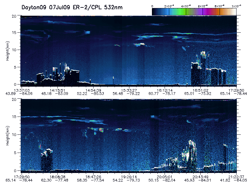
| imgsum_09625_07jul09_532.gif | Flight summary image showing whole flight for 532 nm | |||
| imgsum_09625_07jul09_1064.gif | Flight summary image showing whole flight for 1064 nm | |||
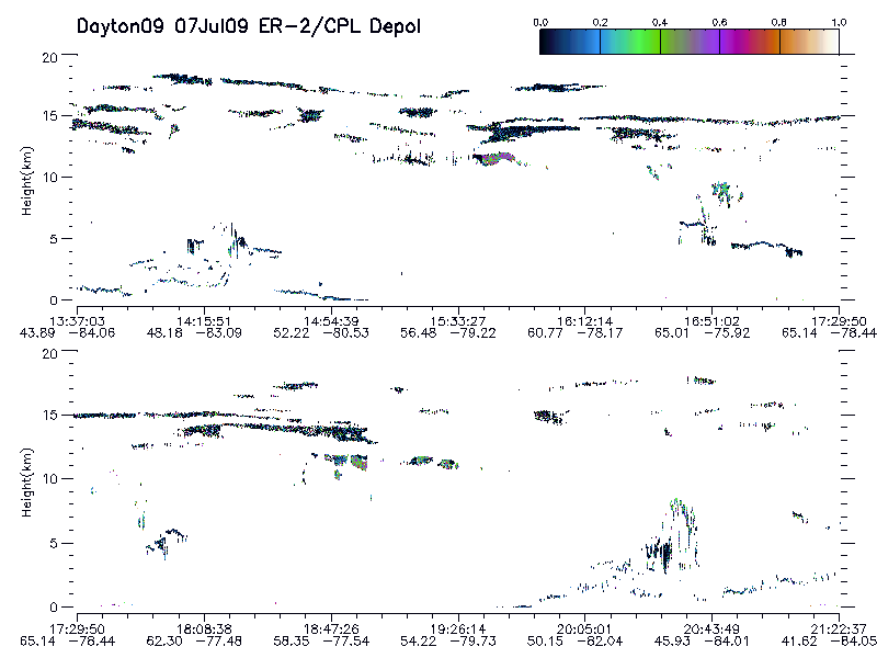
| imgsum_09625_07jul09_depol.gif | Flight summary image showing whole flight for depolarization | |||
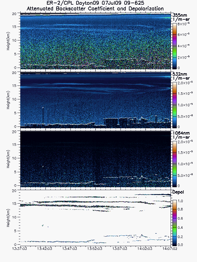
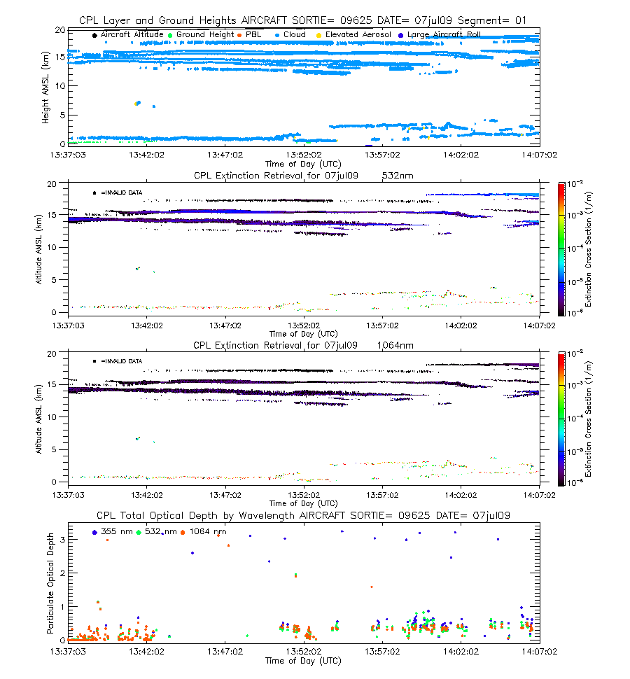
| imgseg01_09625_07jul09.gif | Start time = 13:37:03 End time = 14:07:02 | |||
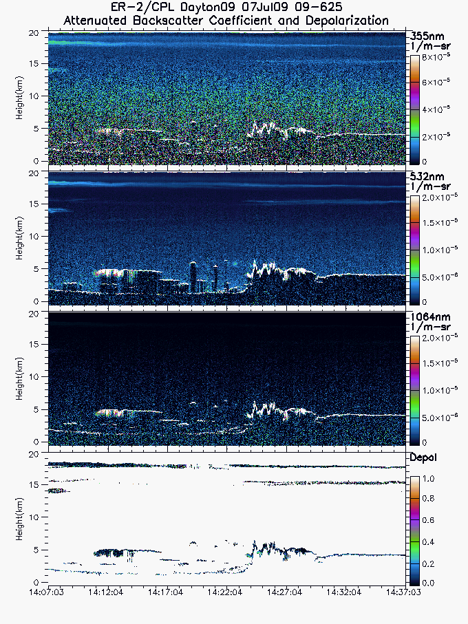
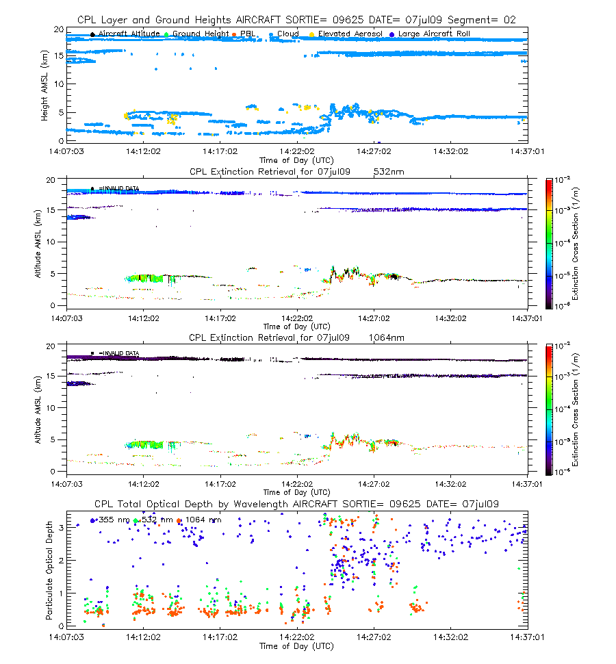
| imgseg02_09625_07jul09.gif | Start time = 14:07:03 End time = 14:37:03 | |||
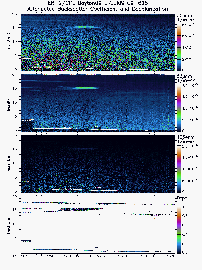
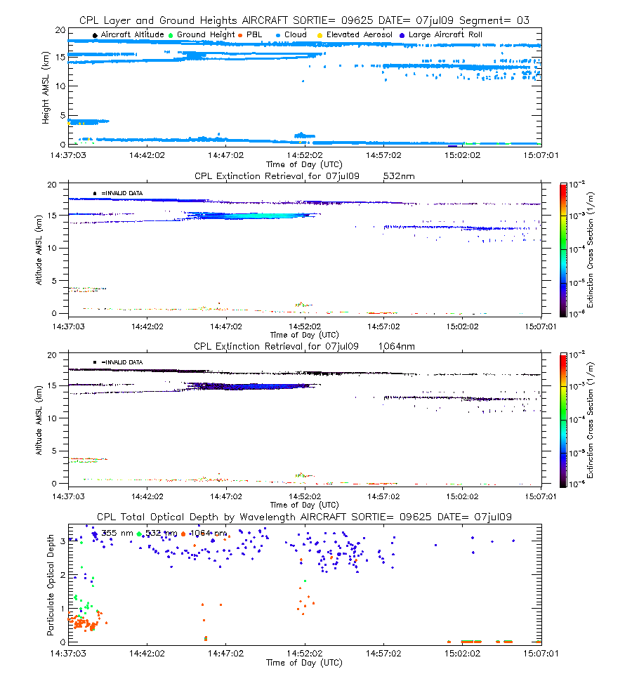
| imgseg03_09625_07jul09.gif | Start time = 14:37:04 End time = 15:07:04 | |||
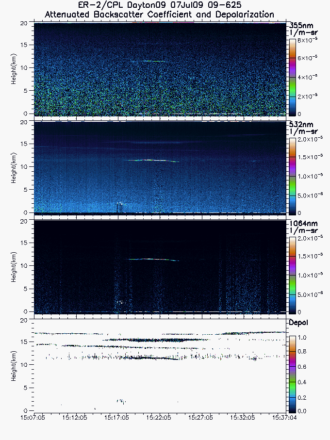
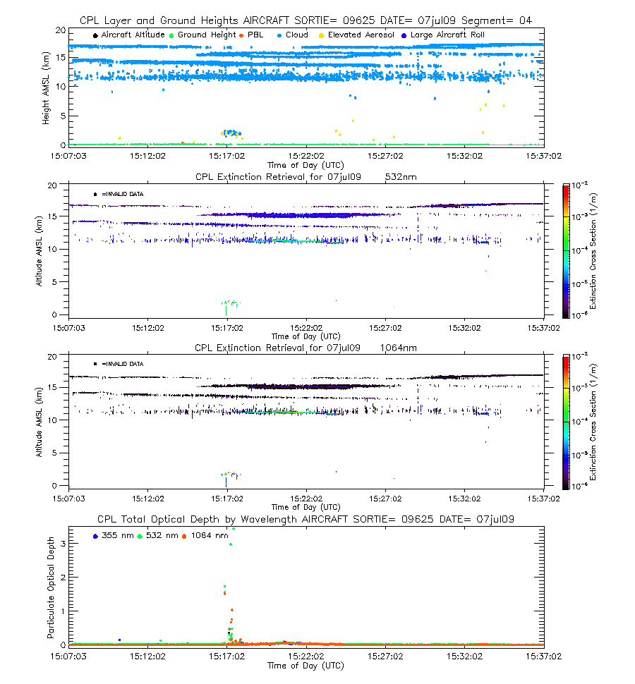
| imgseg04_09625_07jul09.gif | Start time = 15:07:05 End time = 15:37:04 | |||
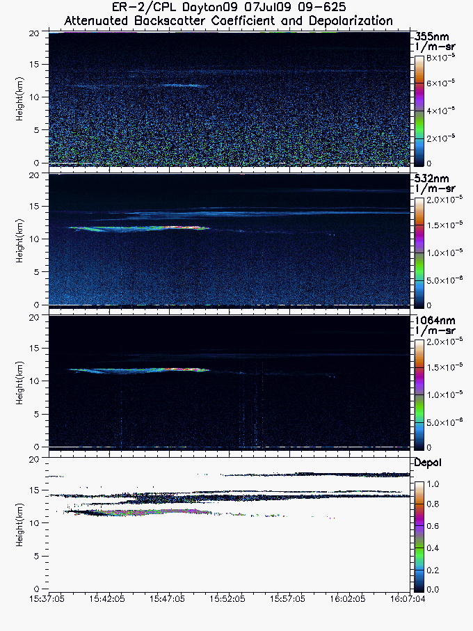
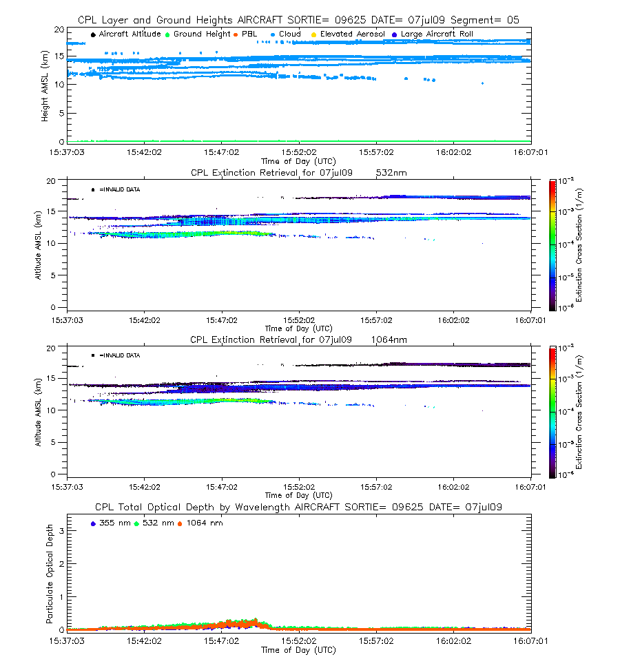
| imgseg05_09625_07jul09.gif | Start time = 15:37:05 End time = 16:07:04 | |||
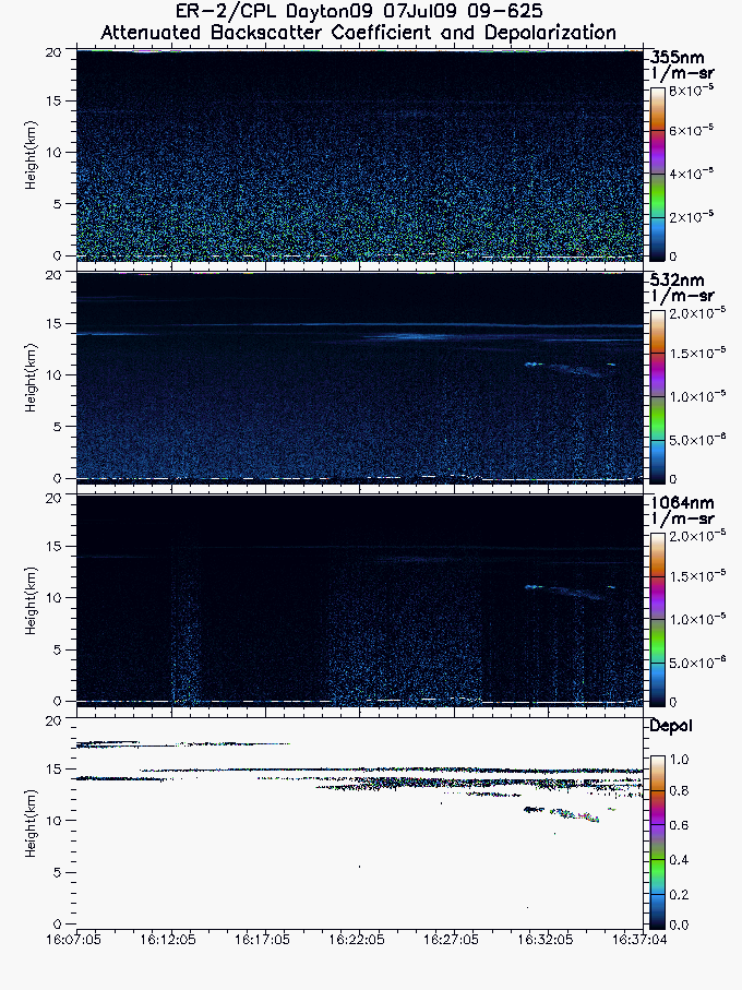
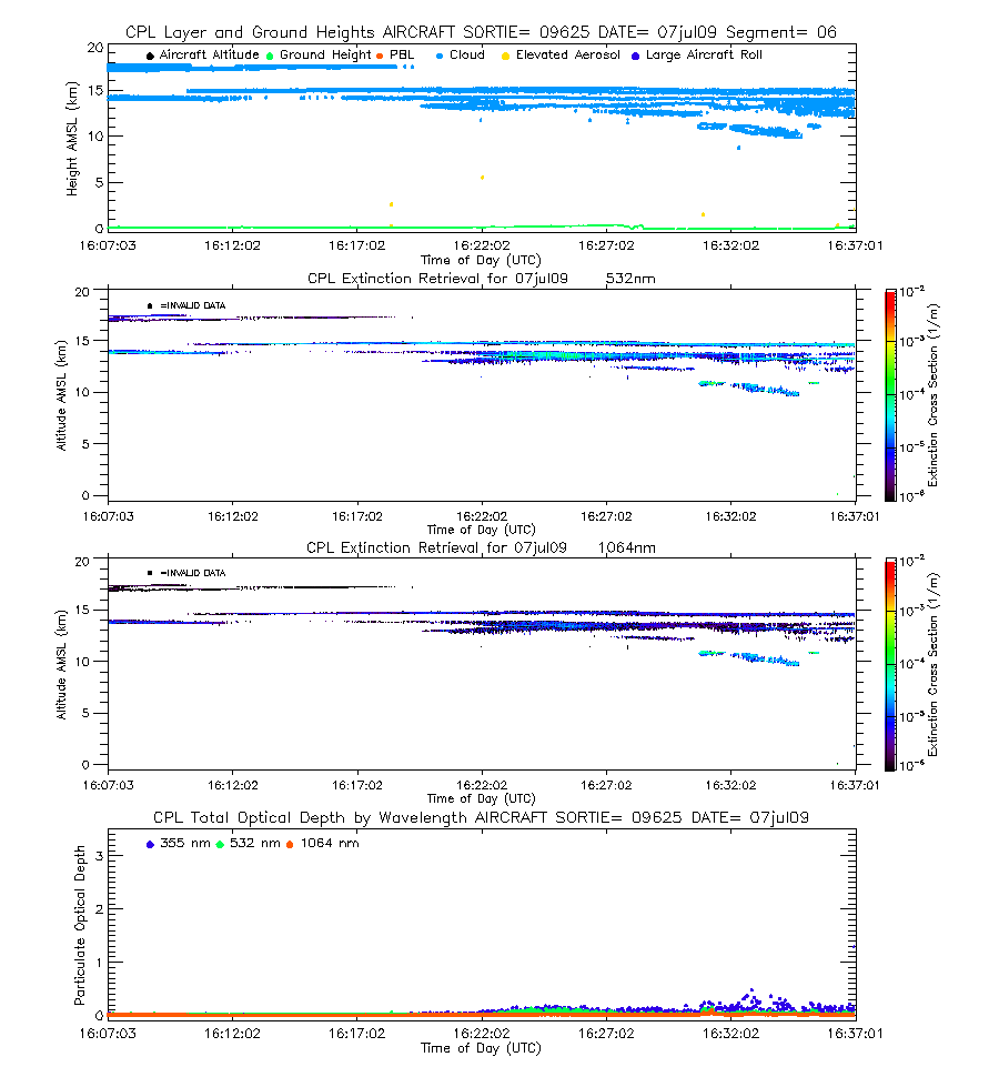
| imgseg06_09625_07jul09.gif | Start time = 16:07:05 End time = 16:37:04 | |||
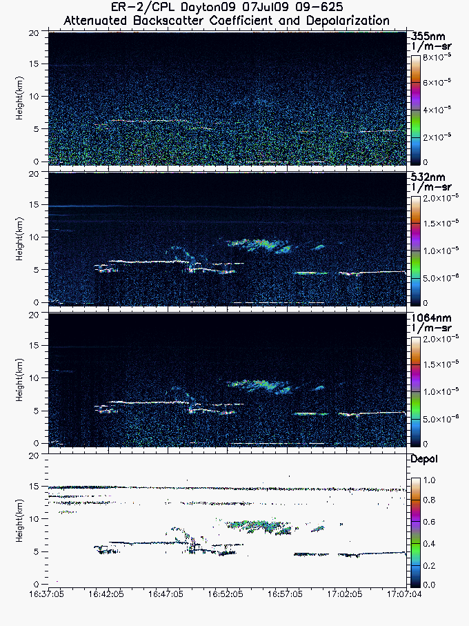
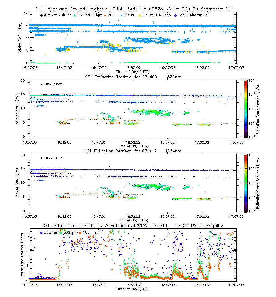
| imgseg07_09625_07jul09.gif | Start time = 16:37:05 End time = 17:07:04 | |||
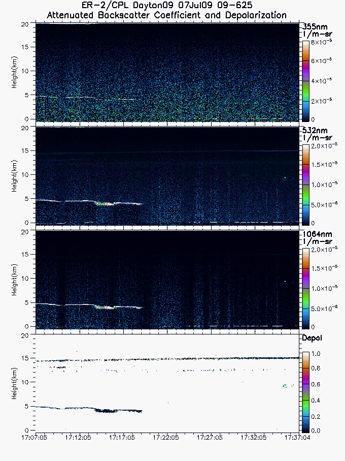
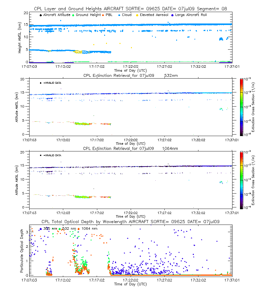
| imgseg08_09625_07jul09.gif | Start time = 17:07:05 End time = 17:37:04 | |||
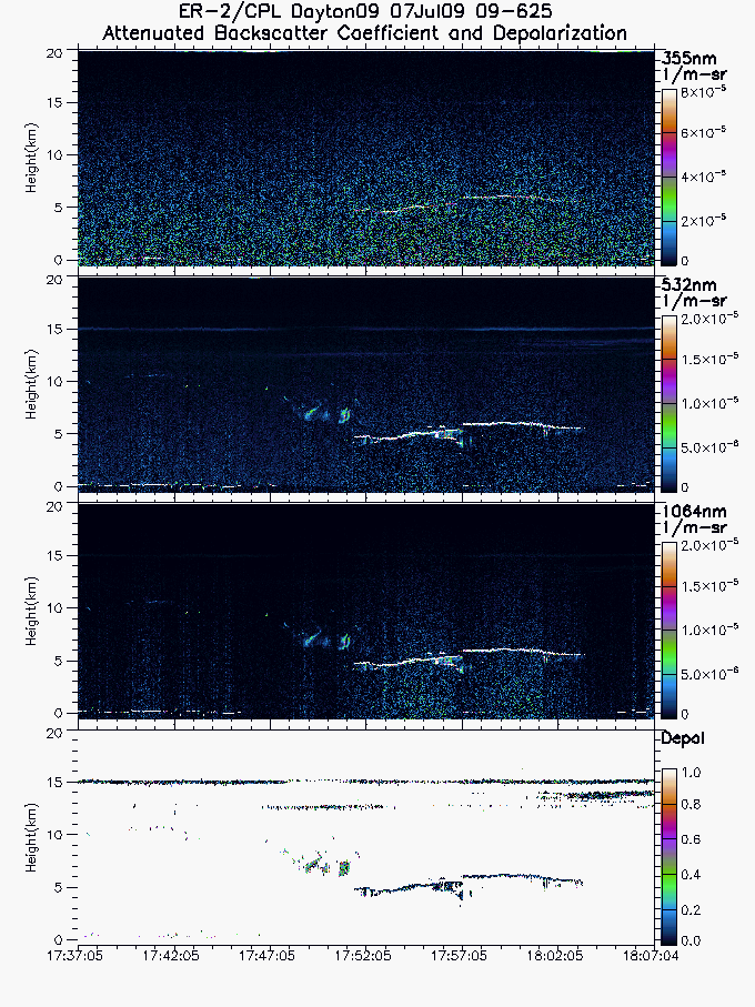
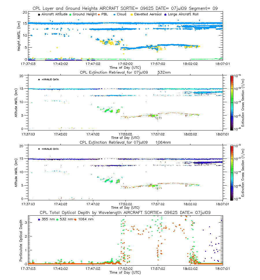
| imgseg09_09625_07jul09.gif | Start time = 17:37:05 End time = 18:07:04 | |||
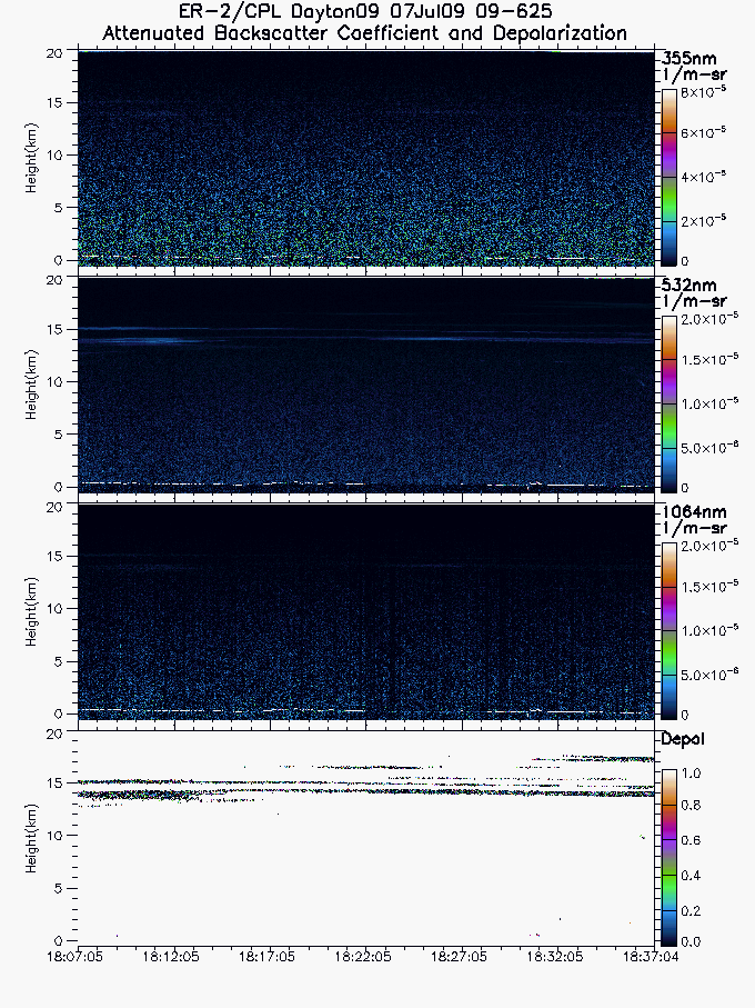
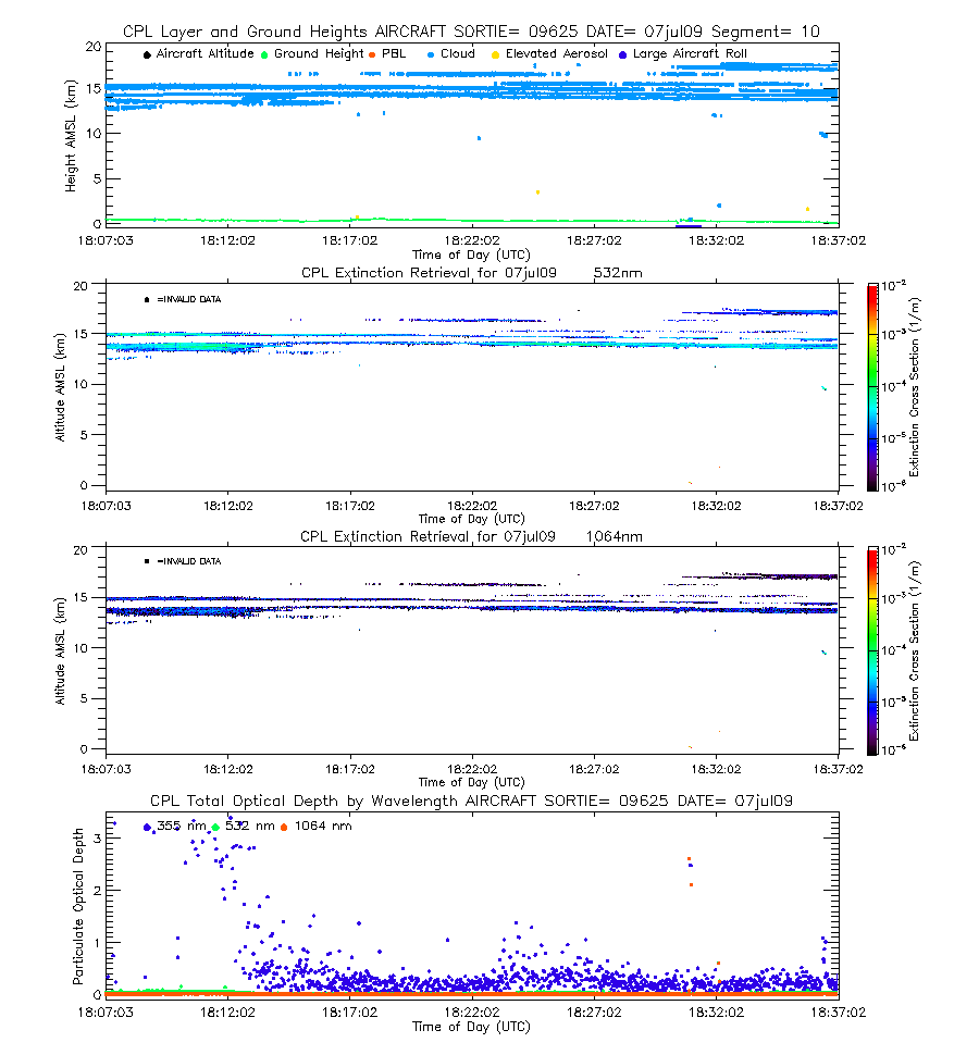
| imgseg10_09625_07jul09.gif | Start time = 18:07:05 End time = 18:37:04 | |||
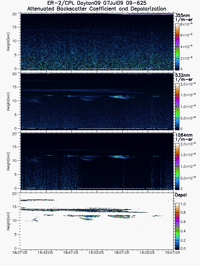
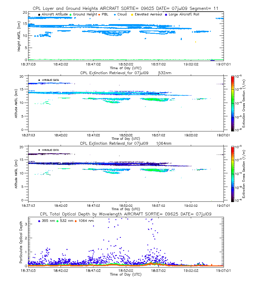
| imgseg11_09625_07jul09.gif | Start time = 18:37:05 End time = 19:07:04 | |||
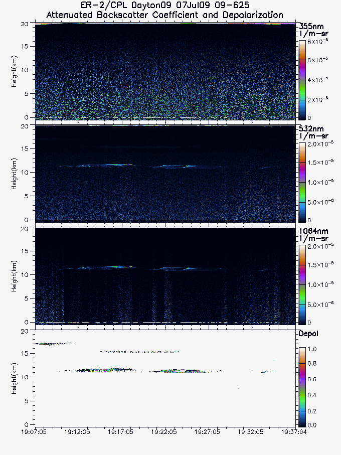
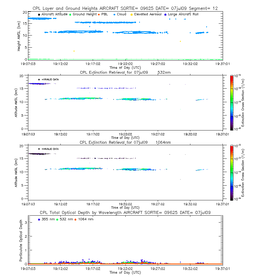
| imgseg12_09625_07jul09.gif | Start time = 19:07:05 End time = 19:37:04 | |||
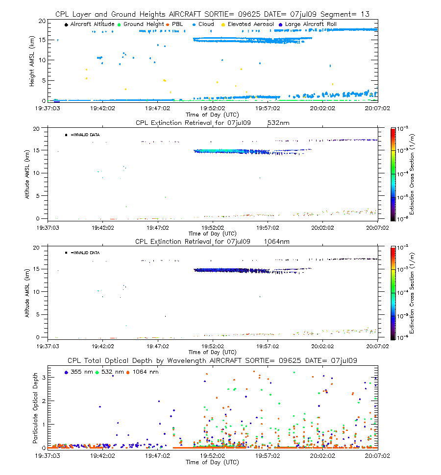
| imgseg13_09625_07jul09.gif | Start time = 19:37:05 End time = 20:07:04 | |||
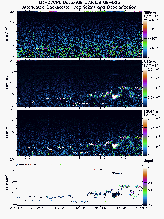
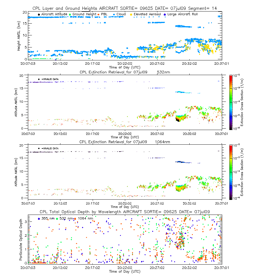
| imgseg14_09625_07jul09.gif | Start time = 20:07:05 End time = 20:37:04 | |||
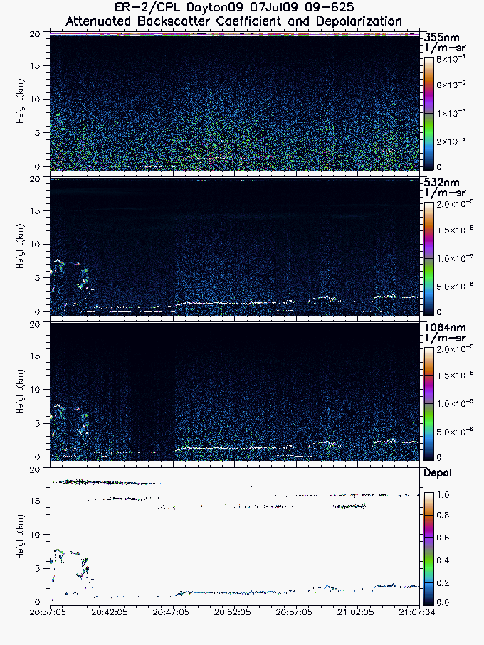
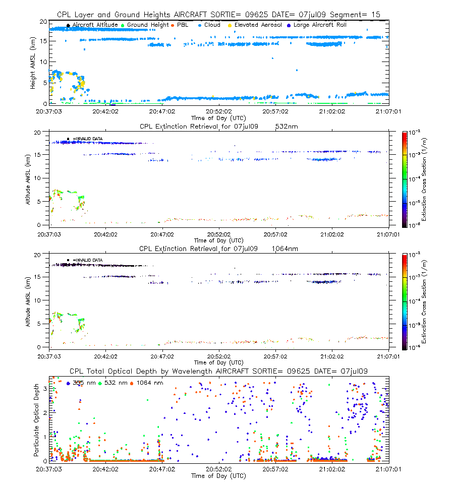
| imgseg15_09625_07jul09.gif | Start time = 20:37:05 End time = 21:07:04 | |||
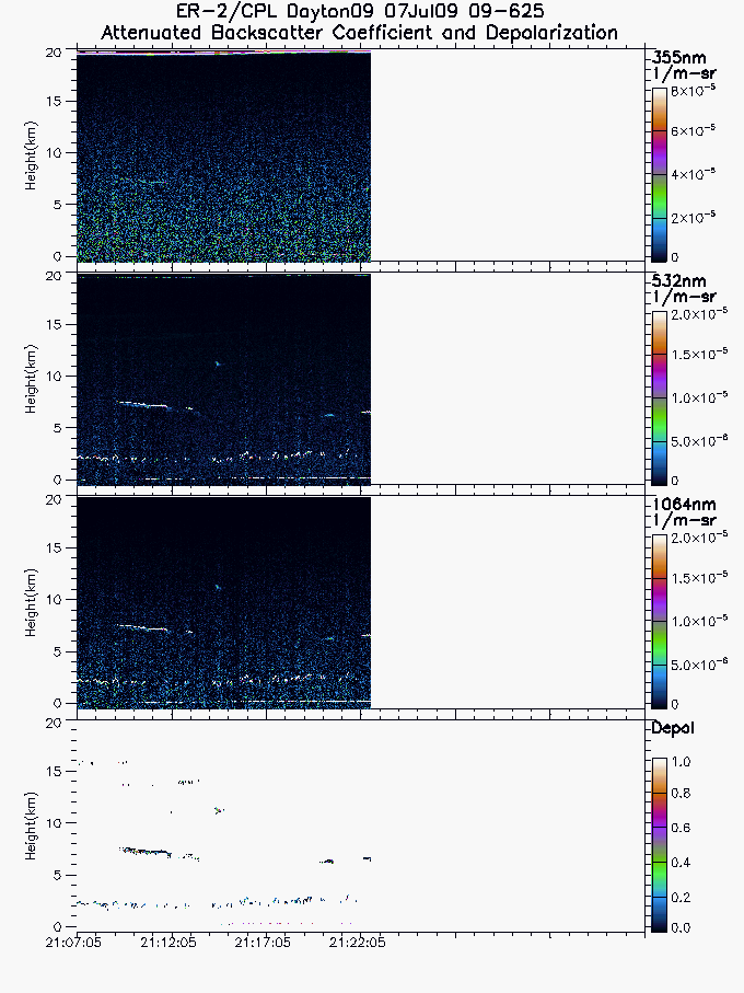
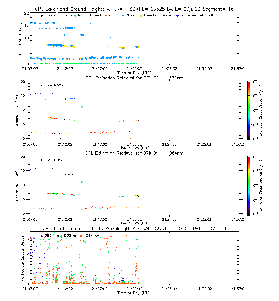
| imgseg16_09625_07jul09.gif | Start time = 21:07:05 End time = 21:22:37 | |||
| layers_09625_07jul09.txt | Layer boundary file showing type and location of all atmospheric layers sensed | |||
| cipbl_09625_07jul09.txt | Quick optical file showing optical depth and extinction-to-backscatter ratio calculations for a pre-defined cirrus zone and the cloud-cleared Planetary Boundary Layer for 355, 532, and 1064 nm. | |||
| CIPBL_readme.txt | Text file describing how to interpret and use the quick optical file. | |||
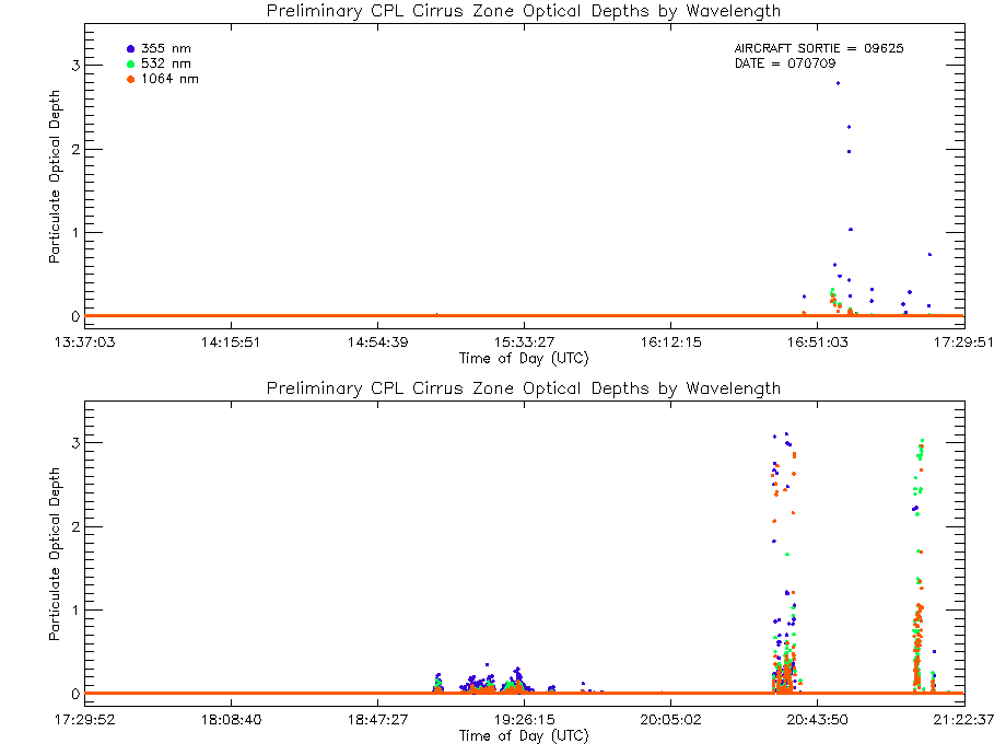
| ciod_09625_07jul09.gif | Optical Depth Plots (Cirrus), from the Quick Optical File | |||
| pblod_09625_07jul09.gif | Optical Depth Plots (PBL), from the Quick Optical File | |||
| Complex Analysis | ||||
| View | ||||
| EXTSEG01_09625_07jul09.gif | Start time = 13:37:03 End time = 14:07:02 | |||
| EXTSEG02_09625_07jul09.gif | Start time = 14:07:03 End time = 14:37:01 | |||
| EXTSEG03_09625_07jul09.gif | Start time = 14:37:03 End time = 15:07:01 | |||
| EXTSEG04_09625_07jul09.gif | Start time = 15:07:03 End time = 15:37:02 | |||
| EXTSEG05_09625_07jul09.gif | Start time = 15:37:03 End time = 16:07:01 | |||
| EXTSEG06_09625_07jul09.gif | Start time = 16:07:03 End time = 16:37:01 | |||
| EXTSEG07_09625_07jul09.gif | Start time = 16:37:03 End time = 17:07:02 | |||
| EXTSEG08_09625_07jul09.gif | Start time = 17:07:03 End time = 17:37:01 | |||
| EXTSEG09_09625_07jul09.gif | Start time = 17:37:03 End time = 18:07:01 | |||
| EXTSEG10_09625_07jul09.gif | Start time = 18:07:03 End time = 18:37:02 | |||
| EXTSEG11_09625_07jul09.gif | Start time = 18:37:03 End time = 19:07:01 | |||
| EXTSEG12_09625_07jul09.gif | Start time = 19:07:03 End time = 19:37:01 | |||
| EXTSEG13_09625_07jul09.gif | Start time = 19:37:03 End time = 20:07:02 | |||
| EXTSEG14_09625_07jul09.gif | Start time = 20:07:03 End time = 20:37:01 | |||
| EXTSEG15_09625_07jul09.gif | Start time = 20:37:03 End time = 21:07:01 | |||
| EXTSEG16_09625_07jul09.gif | Start time = 21:07:03 End time = 21:22:37 | |||
| cod_09625_07jul09.gif | Cloud Optical Depth Plot (three wavelength) | |||
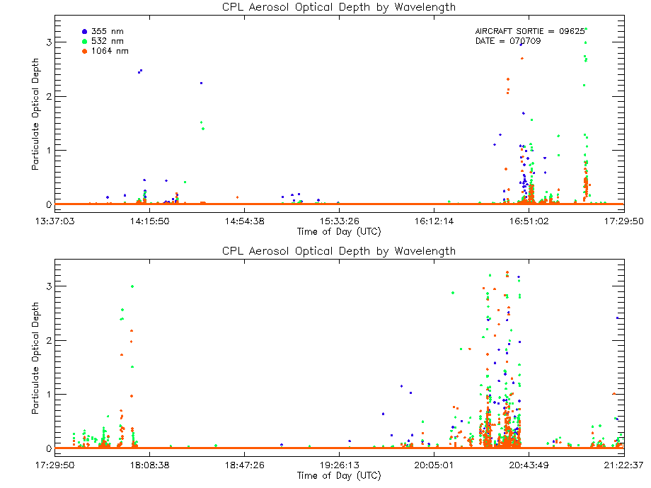
| aod_09625_07jul09.gif | Aerosol Optical Depth Plot (three wavelengths) | |||
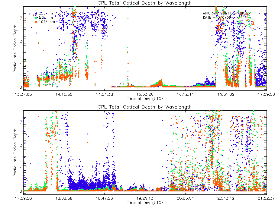
| tod_09625_07jul09.gif | Total Optical Depth Plot (three wavelength) | |||
| Large Binary Output Files | |||
|---|---|---|---|
| NRB_09625_07jul09.xdr | NRB Binary Output containing Lidar profiles after instrument corrections but before calibrated backscatter | ||
| OP_09625_07jul09.xdr | Final Optical Binary Output containing optical properties of every layer sensed, including optical depth, extinction-to-backscatter ratio, and extinction profile for 355, 532, and 1064 nm. | ||
| text | cal_09625_07jul09.final | Request calibration file. This file contains the instrument calibration coefficients used to generate attenuated backscatter data from the NRB binary data. | |
| *Note* Binary output files are large (most files are 500MB). *Note* If you want the binary output files above, please click on the filename to download. |
|||